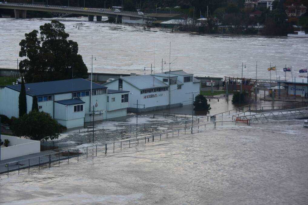
With La Nina confirmed in the Pacific pointing to months of well-above-average rainfall, Launceston's new flood levee system could face an even larger challenge than that posed during the 2016 floods.
Subscribe now for unlimited access.
$0/
(min cost $0)
or signup to continue reading
And since then, a 700-metre levee has been added at Newstead.
But what level of flooding could cause inundation of low-lying areas such as Invermay? And with climate change predicted to increase the frequency and intensity of flooding in Northern Tasmania, how prepared is the city?

Mayor Albert van Zetten said that even with the improved protection afforded by the levees, it was impossible to defend against all flood events. It made preparation all the more important.
"It is important for Launceston residents to be aware that the levees are not a guarantee against flood," he said.
"There will always be a risk of a flood event greater than what the levee system can provide protection for.
"Given the ground conditions in Invermay, there is also a risk of failure. Although the council and the Launceston Flood Authority continually inspect and maintain the levee system, the adequacy of the system can't be guaranteed in every scenario."
MORE ON FLOODING AND CLIMATE IN LAUNCESTON:
In 1929, Launceston was effectively at the mercy of the rushing flood waters as they destroyed 2000 homes and buildings in low-lying areas. The flood level system was started in the 1960s and put to the test in 1969 when, again, the convergence of the North Esk, South Esk and Tamar rose.
In the 2010s, a further 12 kilometres of earth and concrete levees were built, including about 20 Bauer and sliding flood gates with a network of river height sensors. In 2017, a Bushfire and Natural Hazards CRC report found the system prevented $216 million in property damage during the 2016 floods.

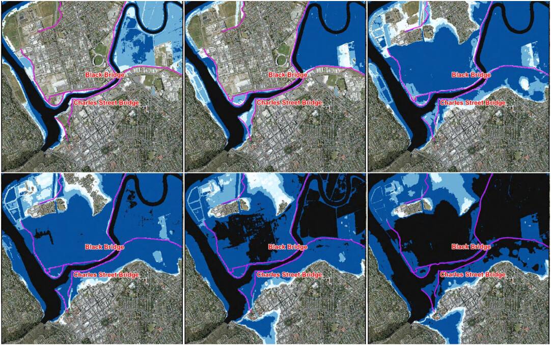
The new system can protect against a one-in-100 year flood, but authorities also have the latest mapping for worsening future scenarios.
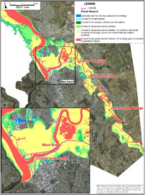
In a one-in-200 year event under current climate conditions, buildings in the area stretching from Newstead College, across Invermay and all the way to Star Theatre could be unsafe for people and vehicles, and vulnerable to structural damage.
In a one-in-500 year event, flooding could extend to Heritage Forest, with all building types in Invermay "vulnerable to failure".
As climate change scenarios by 2040 are laid across the maps, the picture becomes even more dangerous for these areas with waters deepening and the flood footprint extending - in the worst case scenario - across Launceston College, Woolworths and towards Brickfields Reserve.
Cr van Zetten said current modelling indicated that intense rainfall events would become more common in the North and South Esk catchments throughout the 21st century.
"This modelling indicates that while Launceston won't necessarily be at risk of more substantial flooding events in the future, rainfall events will happen with increasing frequency due to the impacts of climate change," he said. "Launceston's reconstructed flood levee system has been designed to a high standard and is expected to provide flood protection to low-lying parts of Launceston for many decades.
Watch: City of Launceston workers test the Charles Street Bauer flood gates in 2018:
"However, no system is failsafe, and Launceston should not be complacent about flood risk."
Jim Collier, a long-term advocate for sediment raking in the Tamar, believed either a dredging or raking program should be carried out in the river's upper reaches, and levees raised further.
"If a significant major flood event does occur, and it really is not a case of 'if' but 'when', this flooding event will only be exacerbated by the risen river bed as the river's upper reaches have, slowly but surely, filled up with more and more sediment since the last raking/dredging program," he said.
In response, Cr van Zetten said a review of sediment raking had found it ineffective in flood defence.
"The City of Launceston completed a review into its sediment raking trial in 2019, with the review finding that sediment raking and prop washing did not achieve their primary goal of net loss of sediment from the upper estuary for the purposes of flood defence," he said.
Cr van Zetten encouraged residents in low-lying areas to have a plan in case of flooding.


